2021: Federal Courthouse, Greenville, South Carolina /
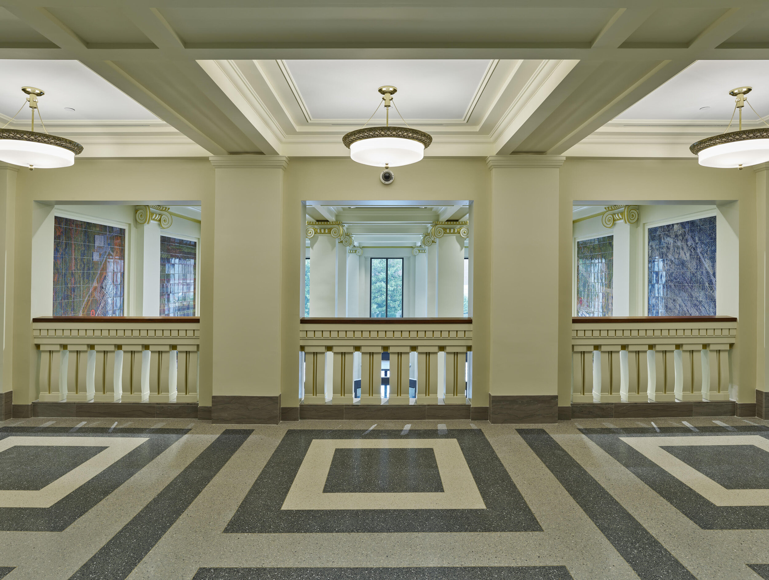
View looking from lobby out toward entrance
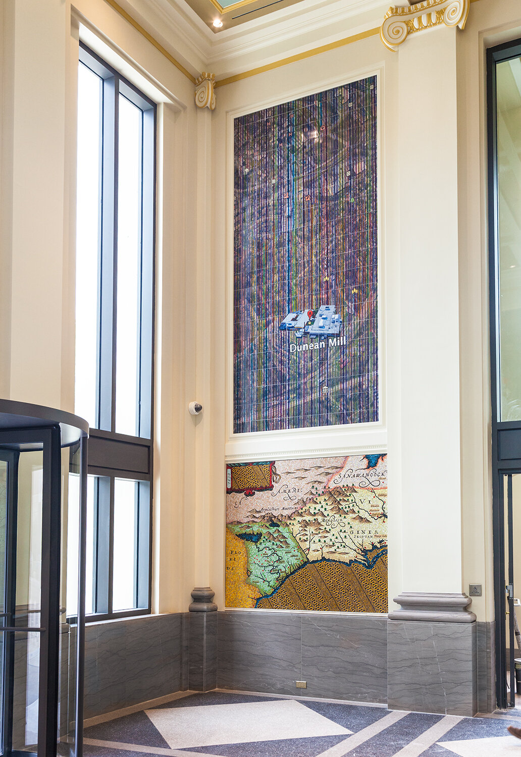
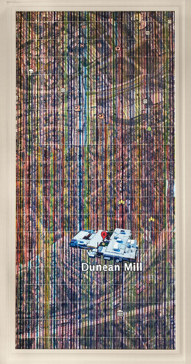
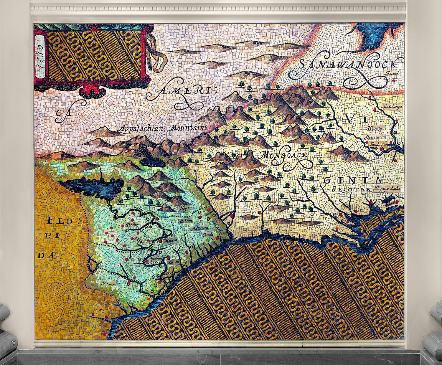
Left Wall above: Dunean Mill, below: 1630 map of Carolina
Dunean Mill, 14’ x 7’, glazed ceramic tiles
1630 map of Carolina, 5’ x 7’; glass mosaics and glazed ceramic tiles
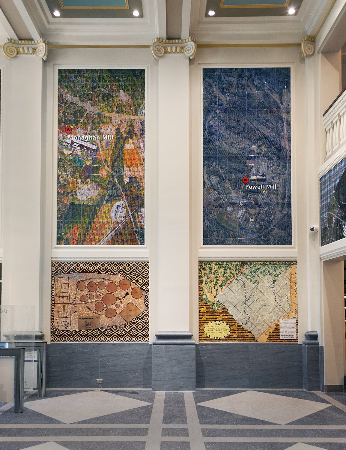
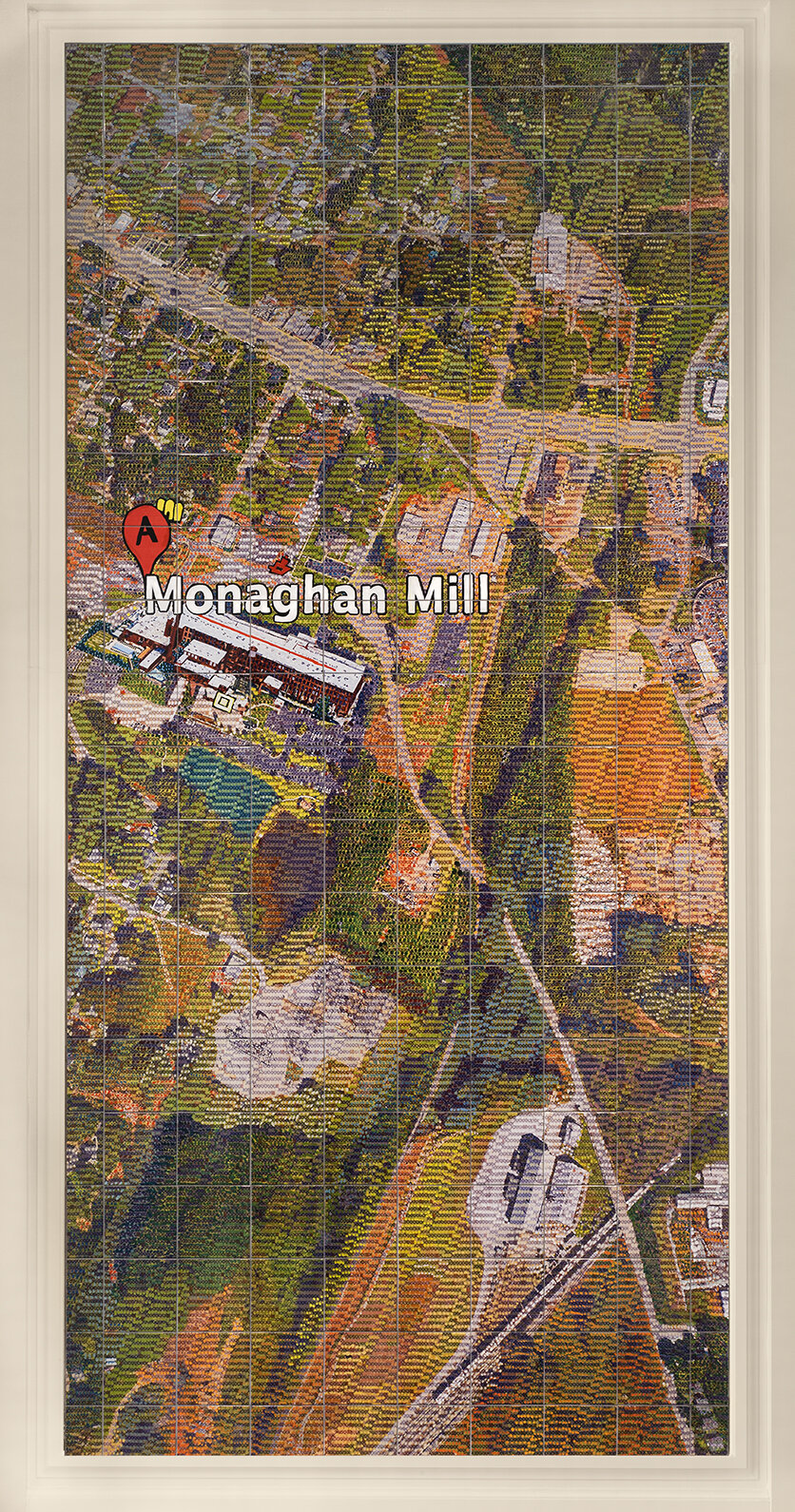
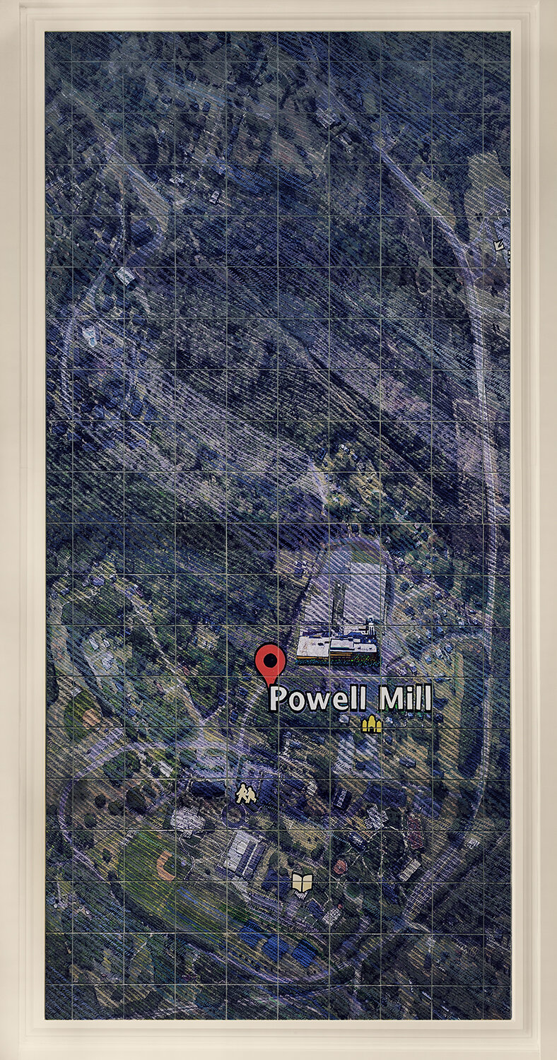
Left Wall above: Monaghan Mill, Powell Mill, below: 1721 copy of map, 1777 map of lands ceded by Cherokee
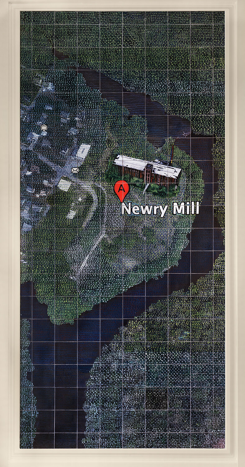
Newry Mill, 14’ x 7’, glazed ceramic tiles
Monaghan Mill, 14’ x 7’, glazed ceramic tiles
Powell Mill, 14’ x 7’, glazed ceramic tiles
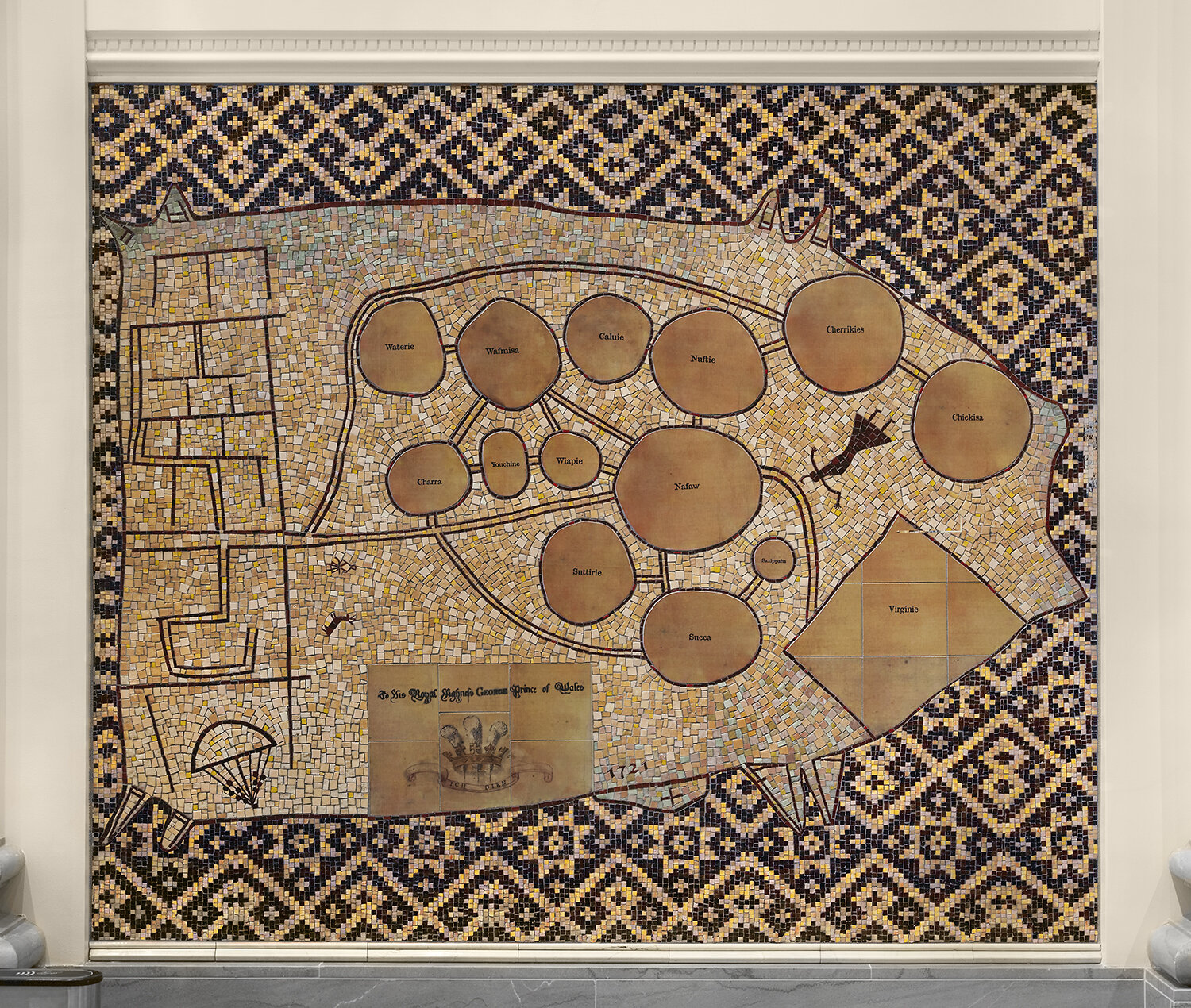
1721 copy of Cherokee map, 5’ x 7’, glass mosaics and glazed ceramic tiles
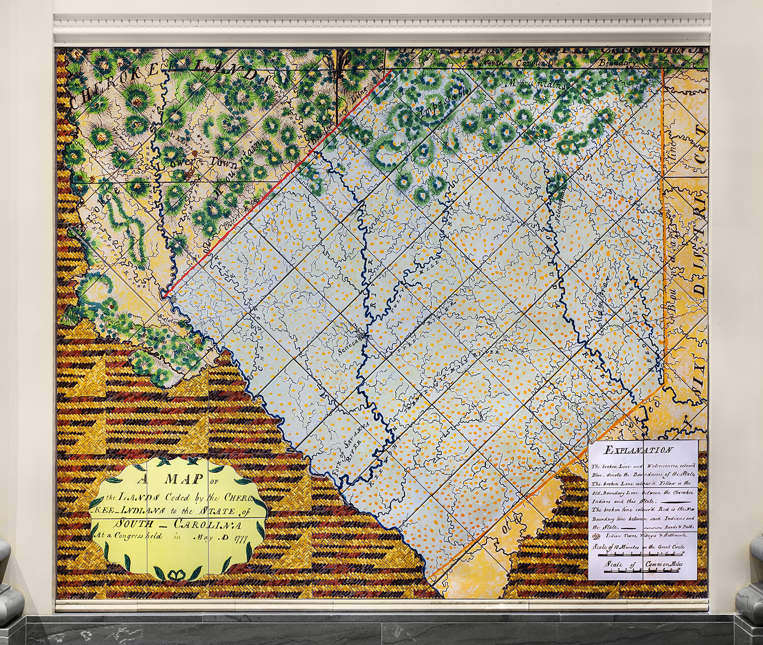
1777 map of lands ceded by Cherokee, 5’ x 7’, glass mosaics and glazed ceramic tiles
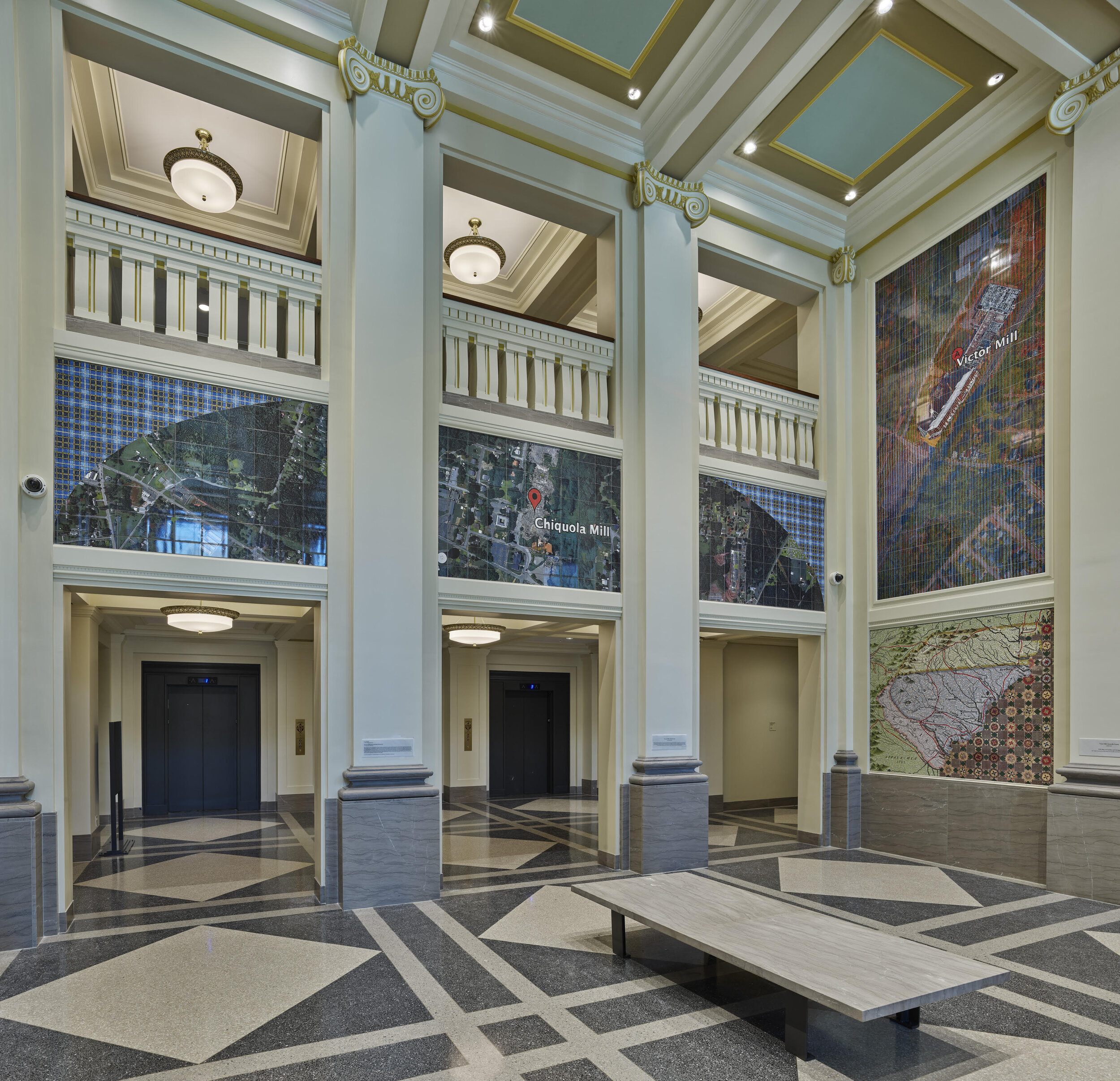
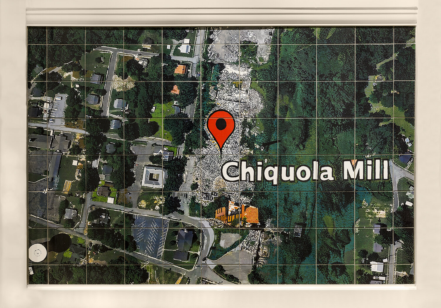
Center and Right Walls, Chiquola and Victor Mills
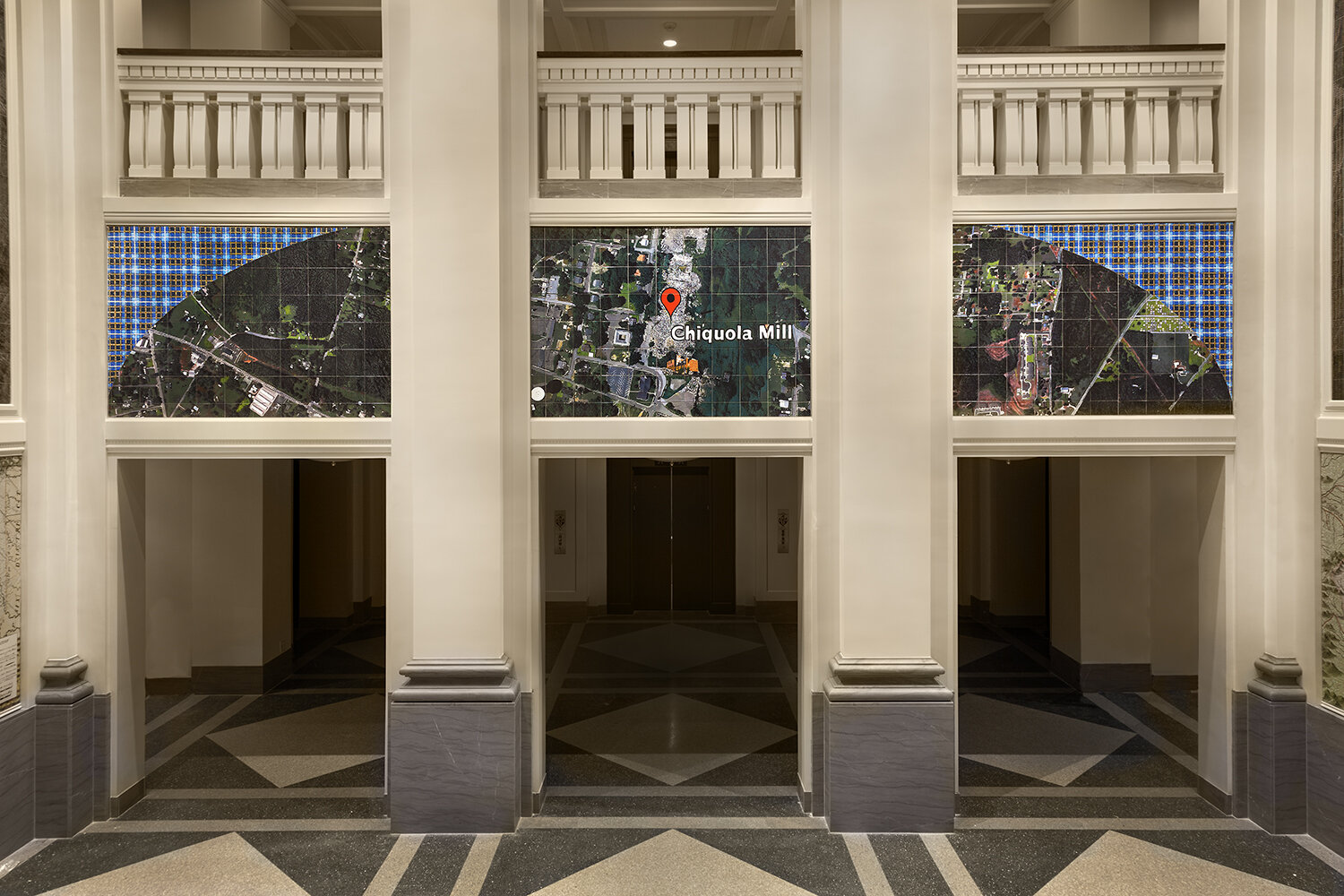
Center Wall: Chiquola Mill, 3 panels
center panel, Chiquola Mill, 4 1/2’ x 6 1/2’, glass mosaics and glazed ceramic tiles
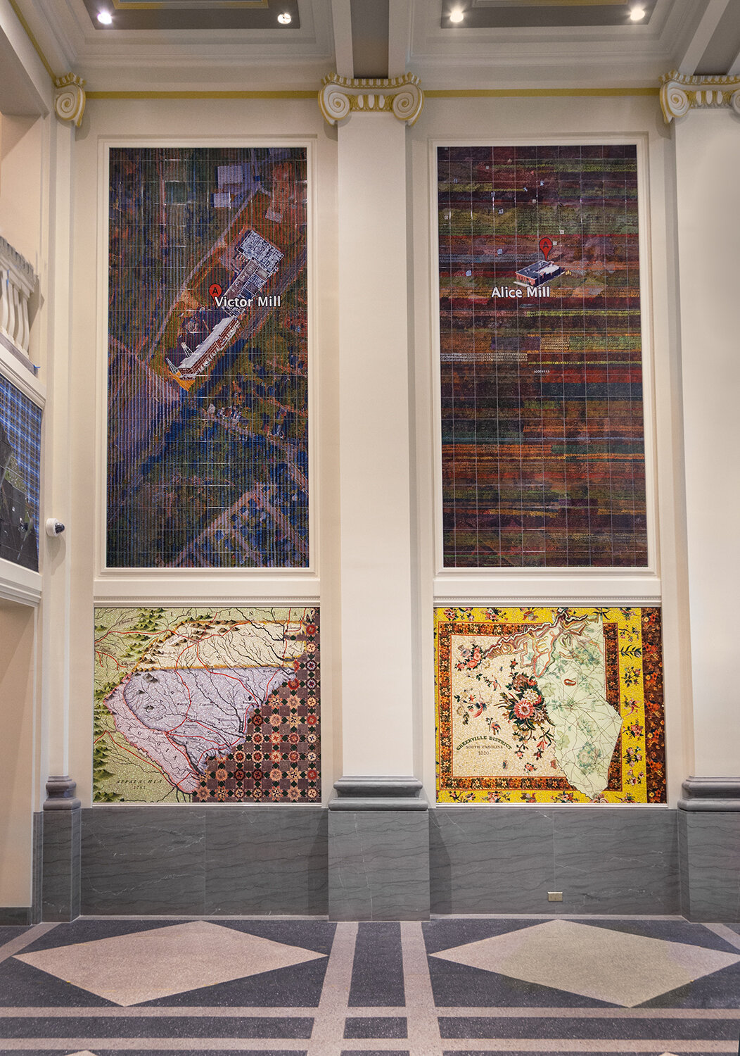
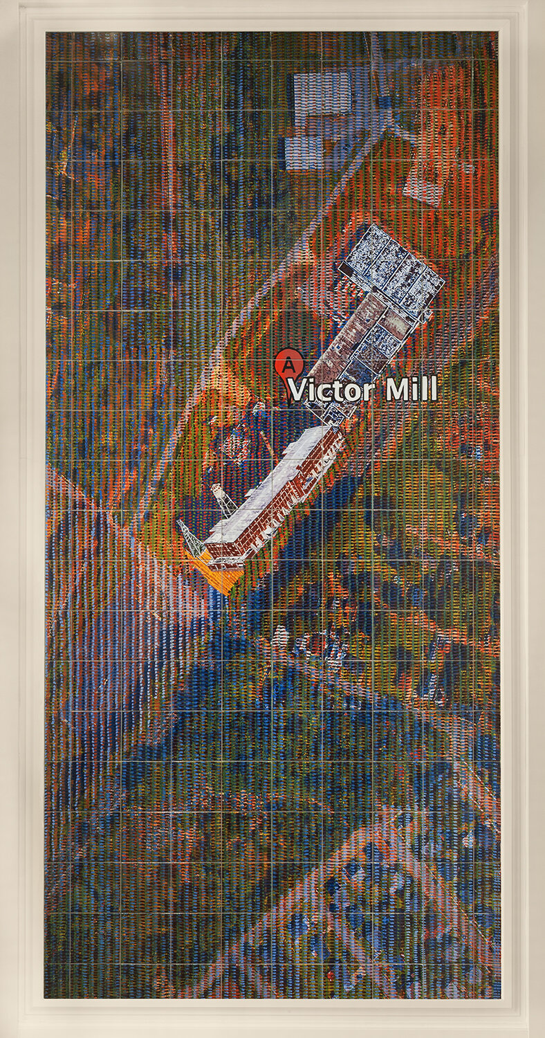
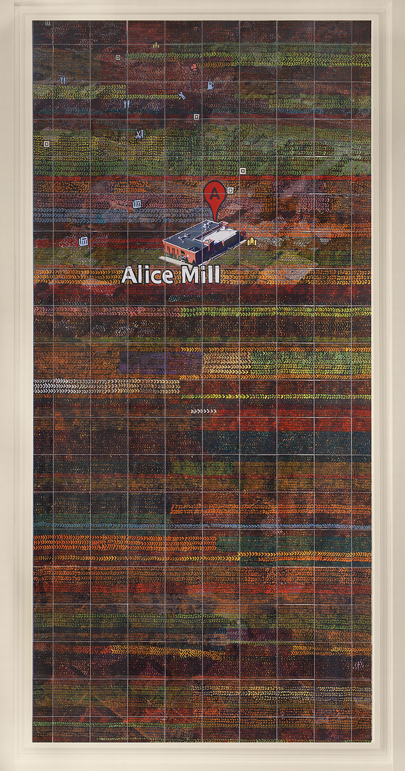
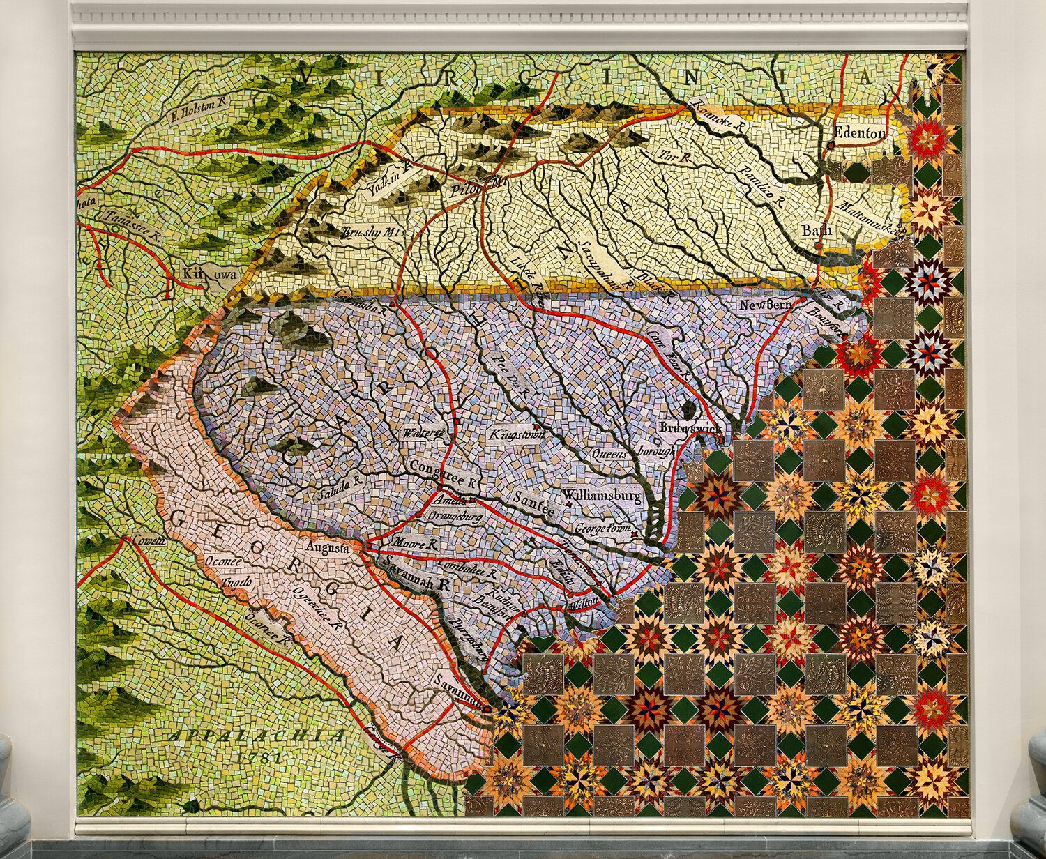
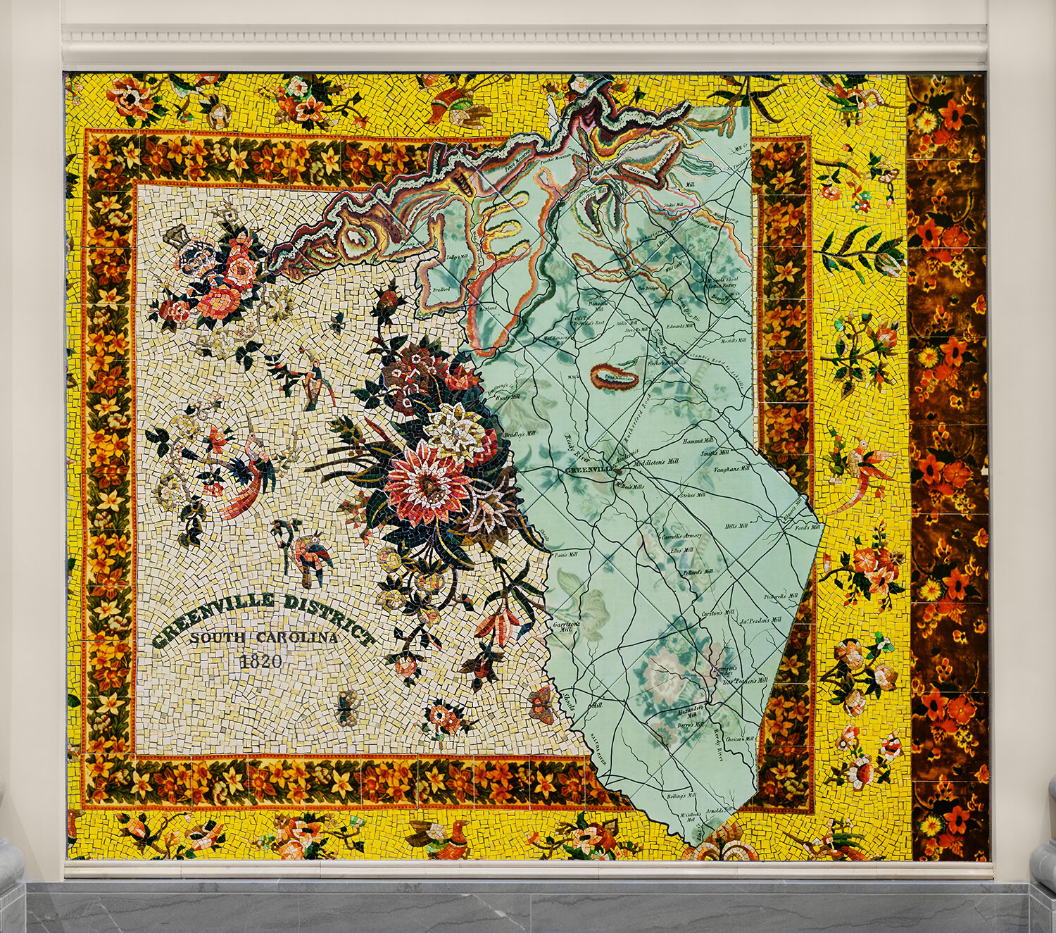
Right Wall above: Victor Mill, Alice Mill, below: 1781 map of the Carolinas, 1820 map of Greenville district
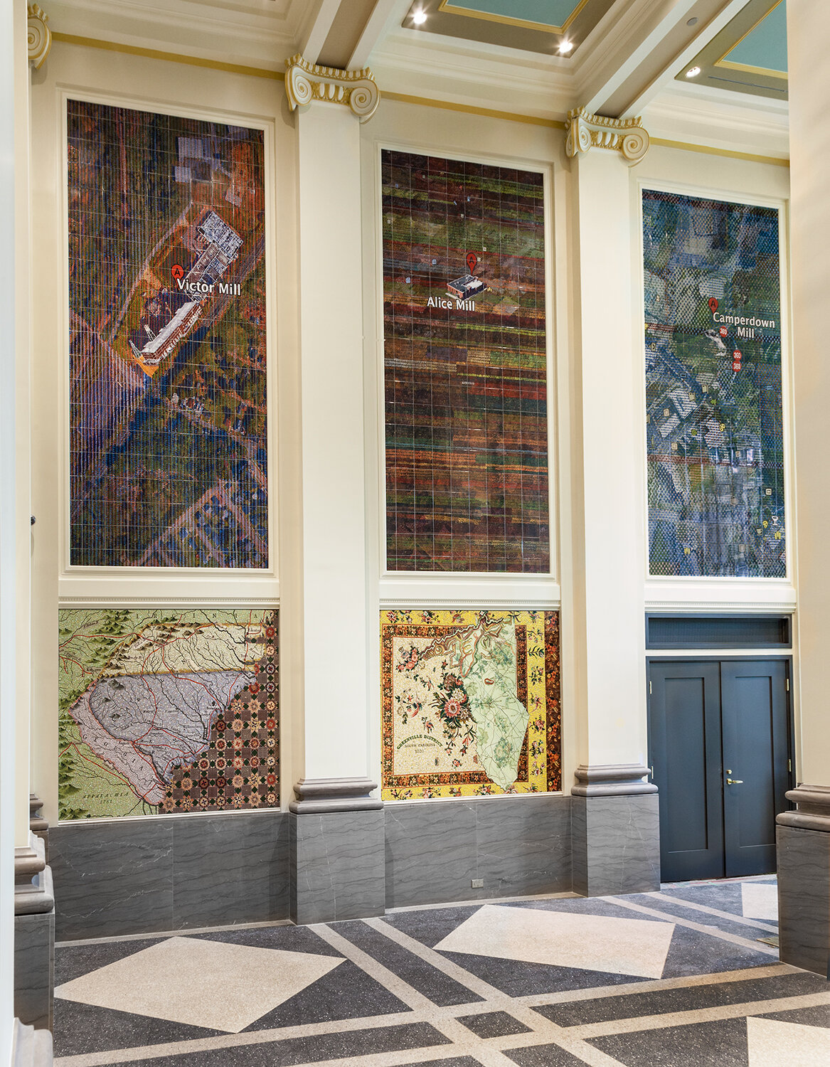
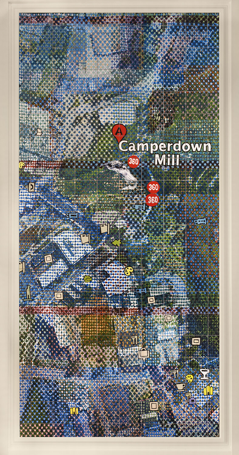
Right Wall above: Victor Mill, Alice Mill, Camperdown Mill, below: 1781 map of the Carolinas, 1820 map of Greenville district
Victor Mill, 14’ x 7’, glazed ceramic tiles
Alice Mill, 14’ x 7’, glazed ceramic tiles
Camperdown Mill, 14’ x 7’, glazed ceramic tiles
1781 map of the Carolinas, 5’ x 7’, glass mosaics and glazed ceramic tiles
1820 map of Greenville district, 5’ x 7’, glass mosaics and glazed ceramic tiles
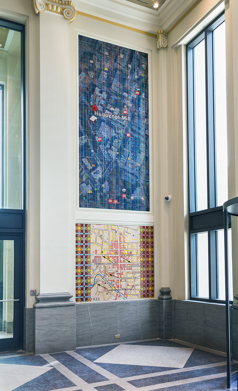
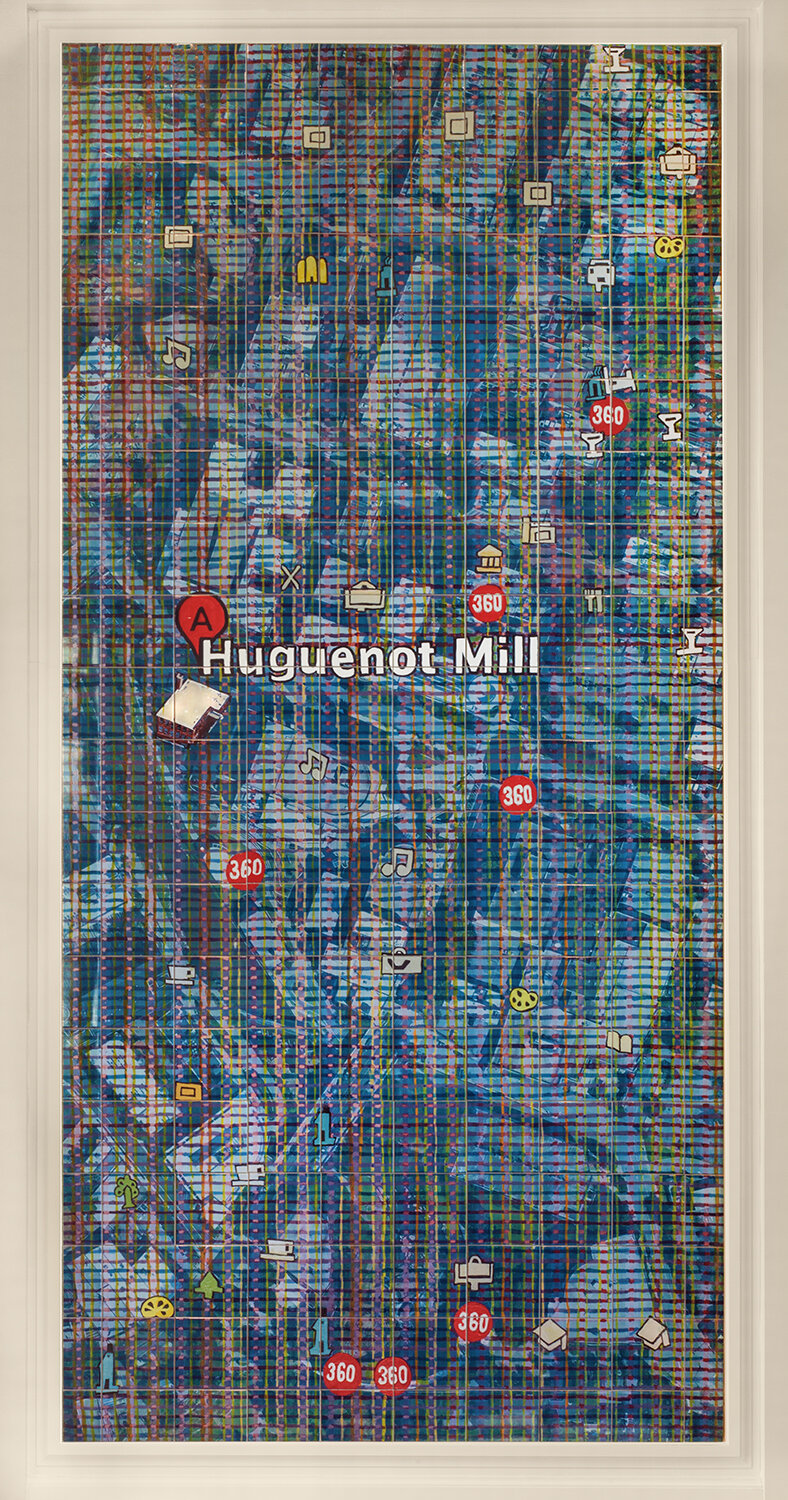
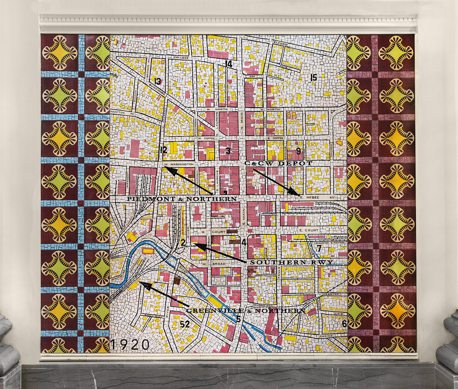
Right Wall above: Huguenot Mill, below: 1930 Greenville Railroad map
Huguenot Mill, 14’ x 7’, glazed ceramic tiles
1930 Greenville Railroad map, 5’ x 7’, glass mosaics and ceramic tiles